Fleets of solar powered drones, positioned between the sun and our earth, casting shadows over areas to temper, cool the effects of solar activity. Panels defusing light reaching our planets surface. Manage paths of major storms by affecting sea surface temperature along temperature gradient lines or warm areas feeding the depression. Defusing the intensity of storms by lowering surface temperatures fueling the storm. Limiting the extraordinary affects of solar flairs when these effects would affect surface weather and equipment.
Independent kites managed by any country interested in the program. Each contributing party aligned to regulations and specifications of the governing body of this program. Rules might limit the square area per shield unit as well as the amount of units each participating entity may deploy.
Examples: A significant depression between Baha and Hawaii might be mitigated.
The storm redirected toward the equator or the intensity of the storm reduced by lowering temperatures fueling the depression.
Any participating entity might elect to join the shield, or not. A major depression, expected to cross over the Philippines. Filipinos call for shielding but, greater Asia does not want to participate fully because, Asia needs well managed, seasonal monsoons. Still, they deploy some shields to lessen the effect at the Philippines, adding to the Filipino and their allies, shield system.
These kites might be made of several powered units managing large sheets of perhaps silver Mylar film. Six drones, four for the corners with perhaps two midway of a modest rectangle sheet of Mylar film that reflects sun light back into space while defusing light reaching earths surface. Silver Mylar, an example for this discussion, until a more UV resistant and effective material is found. In this example, the drone units are launched as a single unit with the rolled or folded solar shield. When in position, the drone system deploys the sun shield. When expected to move significant distances, for less air resistance during the logistical maneuver the drones roll or fold the shield. Think "Solar Impulse2" with Osprey or Harrier like mechanics. for form, and power. Might not need to support many batteries for polar projects. Gas bladders, filled with a less dense gas, as helium, to help maintain system altitude when in position, as a kite tail to provide drag when the drone, facing wind needs to manage the sail. Gas released when expected to move a significant distance or high winds hinder control. Compressed gas contained and managed similar to standard consumer type CO2 cartridges.
Kites used to redirect sunlight to desert or sea based solar array facilities, during their night hours.
Kites used over earth poles to reduce melt during summers. Contain land, subsurface methane trapped in permafrost, as well as manage marine, methane clouds. Marine methane clouds should be harvested then by burning as fuel, converted to the less harmful global warming gas, CO2.
These shielding modules might be reduced when, perhaps, gold leaf (UV resistant) or gold plated shields are launched into space beyond our moon and magneto sphere. Laser positioned to the north and south poles during summer seasons. Repositioned during solar storms, protecting orbiting satieties and land based electrical systems from extraordinary solar activity.
Proposals to YourRep@YourGovernment.gov
Please send me a copy too, Include SkyKite in your subject line.
Send to: salt@spiced.com
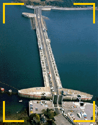
(Usine maremotrice de la Rance) was built in the 1960's near St. Malo in France. A dam 330 metres long was build in front of a 22 square kilometer basin. The tidal range (the difference between high and low tides) averages 8 metres and reach up to 13.5 metres.
The plant consists of 24 bulb type turbine generators 5.35 metres in diameter, 470 tonnes in weight, and rated at 10MW each which generate electricity whether the tide is going in or out (developed by �lectricit� de France). This peak of 240MW of power is sufficient to power 4% of the homes in Brittany - equivalent to the consumption of a town the size of Rennes. The average power generated is 68MW for an annual output of around 600 million kWh units of electricity.
In November 1996 the La Rance tidal power plant celebrated 30 years of active service during which time 16 billion kWh of electricity were generated without major incident or mechanical breakdown. The initial capital cost of the power plant (620 million Francs) has long since been recovered, and the cost of electricity production is now below 0.02 Euro per kWh.
Links below the page are interesting too, Related Articles and Products
At coasts with modest tide movements, other ways to take advantage of the natural inbalance, tide and ocean currents, might be taken advantage of.
There are at least two types of reliable ocean currents. 1. Great currents as the Pacific Gyre or the Atlantic Gulf Stream. 2. Tidal or Moon gravity effects at local water bodies, being the other. Tidal effects vary by location. Tides are a water bulge. This discussion has relevance for tidal currents. The rising tides generally come from the east, the flow of the receding or outgoing tide might move in the opposite direction as gravity flattens the water surface so, the flow might somewhat reverse, especially from a contained body as a bay with a narrow mouth. Direction can vary because of land structures in the tidal current, how water flows into and around structures. There are current layers too. If a bay is being filled with the incoming tide from deep ocean and the mouth of the bay is reef or shallow, the fill flow will probably be most prominent at the surface layer of the near open ocean. If the land mass is large and somewhat perpendicular to the tide flow. the current will concentrate and flow toward the area with less resistance.
The concentrated flow is useful. Epic daily currents around Nova Scotia. The east coast of Canada, United States and Japan, more then adequate for energy production. Wonder what the flow rate is near Gibraltar, the Denmark and Germany coastlines; with lunar forces going in the opposite direction of the land mass and the adjusting seas, compared to the east coasts of the Americas.
Search terms might be Boston Tide Chart or, Hiroshima Japan Tide Chart.
Where I am, we have four changes per day, two high and two low tides. Of the high tides one usually is taller. The higher tide referred to as the High-high tide. On a good tide day, the High-high is less than a meter tall even with a decent low low. Not ideal but, still powerful at certain sites, say, the mouth of Pearl Harbor. Surface area of the bay times the height equals about, how many cubes of water move through the mouth of Pearl Harbor, four times a day. Of course, placed sea structures cannot impede shipping lanes or affect harmfully, the area, even down current flow.
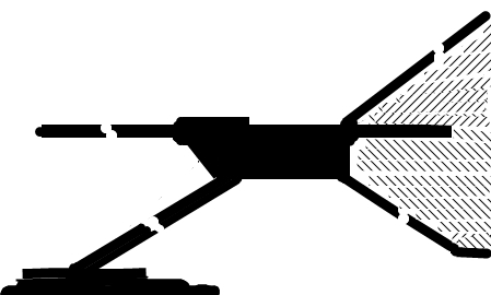
I appreciate the many examples of systems on bottom of this Page Link however, they do not address some of my concerns. Concerns being, environmental, maintenance, esthetics or esthetics and, efficiency properties of a system. Using this example to explain my concerns:
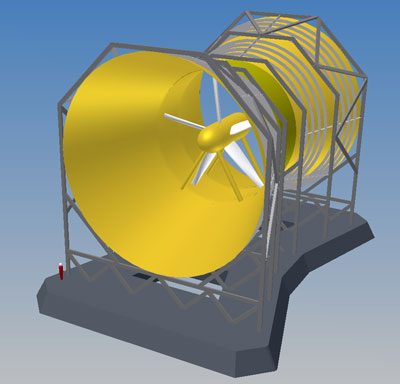 Fish and other ocean life are at risk when an improper system is placed where these creatures may frequent.